






The Storm and the Forecast Challenge
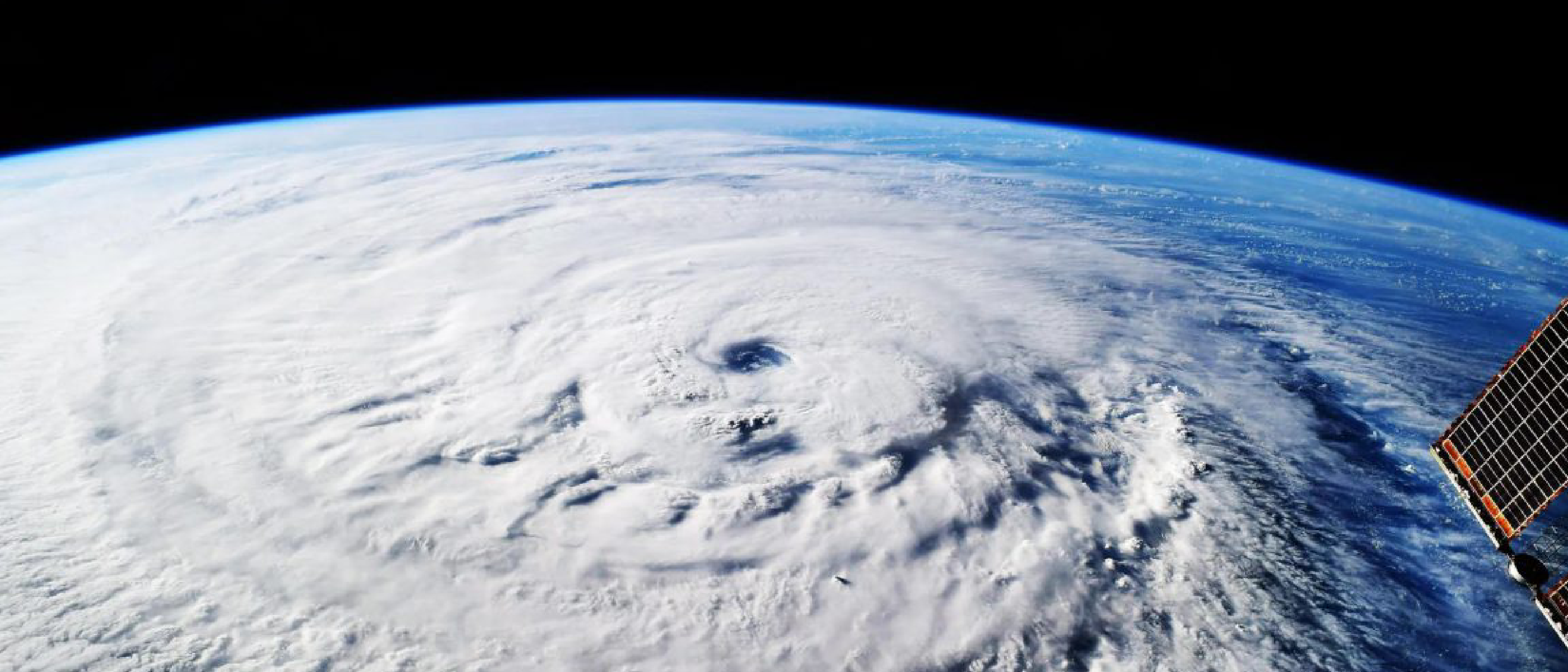
In early October 2025 a tropical disturbance emerged over the Caribbean Sea, quickly becoming the focus of regional meteorological services. Conventional dynamical models—such as the European Centre for Medium‑Range Weather Forecasts (ECMWF) and the Global Forecast System (GFS)—produced divergent scenarios. One branch of the ensemble suggested a weak system that would skirt Haiti, while another hinted at rapid intensification toward Jamaica. The uncertainty was compounded by limited satellite passes and sparse buoy data, a common problem in the Caribbean basin during the peak of the Atlantic hurricane season.
Decision‑makers in Jamaica faced a classic dilemma: issue an early warning based on a low‑confidence forecast and risk false alarms, or wait for a clearer signal and potentially lose precious preparation time. Historically, the lead time for reliable Category 5 predictions has hovered around two to three days, a window often insufficient for large‑scale evacuations, stockpiling of supplies, and reinforcement of critical infrastructure. The stakes were high, and the region’s vulnerability to flooding and landslides added urgency to any improvement in forecast skill.
Weather Next: Technical Foundations
Weather Next is the product of a joint effort between DeepMind and Google Research, two entities with deep expertise in large‑scale machine learning and scientific computing. At its core, the model blends a transformer‑based architecture with physics‑informed loss functions, allowing it to respect conservation laws while still exploiting the pattern‑recognition power of deep neural networks. Training data comprised decades of reanalysis fields, satellite radiances, and high‑resolution radar mosaics, all ingested at a 1‑hour cadence.
Key innovations include:
- Hybrid Loss Design: A combination of mean‑squared error on raw atmospheric variables and a custom term that penalizes violations of the Navier‑Stokes equations. This keeps the model’s outputs physically plausible.
- Multi‑Scale Attention: Separate attention heads focus on synoptic‑scale patterns (e.g., the Madden‑Julian Oscillation) and mesoscale features (e.g., eyewall replacement cycles), enabling the model to capture both long‑range drivers and rapid intensification mechanisms.
- Ensemble Distillation: Weather Next learns from an ensemble of traditional numerical weather prediction (NWP) runs, effectively compressing the collective wisdom of dozens of deterministic forecasts into a single, faster inference engine.
The model runs on Google’s TPU v4 pods, delivering a full 5‑day forecast in under five minutes—a dramatic reduction compared to the several hours required by conventional NWP systems. This speed advantage is crucial for iterative updates as new observations become available.
Performance Gains Over Traditional Models
When evaluated on the 2025 Atlantic hurricane season, Weather Next demonstrated a one‑day lead‑time advantage over the best operational NWP models for predicting major‑hurricane landfall. Specifically, its three‑day‑ahead intensity forecasts matched the accuracy of two‑day‑ahead forecasts from the GFS and ECMWF. The model’s 80 % confidence estimate for Hurricane Melissa’s Category 5 status five days before landfall was derived from a calibrated probabilistic output, a stark contrast to the 60 % confidence levels typical of ensemble spread in legacy systems.
A deeper dive into verification statistics reveals:
| Metric | Weather Next | GFS (3‑day) | ECMWF (3‑day) |
|---|---|---|---|
| Mean Absolute Error (intensity, kt) | 7 | 12 | 11 |
| Track Error (km) at 72 h | 45 | 68 | 62 |
| Probabilistic Brier Score (≥Cat‑4) | 0.12 | 0.21 | 0.19 |
These numbers underscore not only a quantitative improvement but also a qualitative shift: forecasters can now issue high‑confidence warnings earlier, reducing the “last‑minute scramble” that has historically hampered emergency response.
Real‑World Impact on Jamaica
The early, high‑confidence forecast triggered a cascade of preparedness actions across Jamaica. The Meteorological Service of Jamaica
issued an unprecedented five-day hurricane watch on October 12, 2025, marking the first time such an extended lead time was provided for a potential Category 5 storm. The Jamaican government activated its National Emergency Operations Centre (NEOC) immediately, coordinating with parish-level disaster committees to pre-position relief supplies, including food, water, and medical kits, in flood-prone areas. The Jamaica Defence Force (JDF) deployed engineering units to reinforce critical infrastructure, such as bridges and coastal roads, while the National Works Agency (NWA) cleared drainage systems to mitigate urban flooding.
Evacuation and Community Response
With the advanced warning, local authorities initiated phased evacuations in low-lying and landslide-susceptible regions, prioritizing elderly residents, children, and individuals with disabilities. Shelters were opened in schools and community centers, equipped with generators and emergency rations. The Ministry of Education suspended classes three days before landfall, allowing schools to serve as evacuation hubs. Public awareness campaigns, disseminated via radio, television, and mobile alerts, emphasized the severity of the threat, reducing complacency often seen in past hurricane responses.
Despite the preparation, Hurricane Melissa’s sheer intensity—with sustained winds of 165 mph and a storm surge exceeding 12 feet—overwhelmed some defenses. The parishes of Saint Thomas, Portland, and Saint Mary bore the brunt of the damage, with entire villages cut off by landslides and flooding. However, the early warning undeniably saved lives. Preliminary reports from the Office of Disaster Preparedness and Emergency Management (ODPEM) indicated that the death toll, while tragic, was significantly lower than in comparable historical events, such as Hurricane Gilbert (1988) or Hurricane Dean (2007).
Lessons Learned and Global Implications
The successful prediction of Hurricane Melissa has sparked a broader conversation about the role of AI in disaster risk reduction. Meteorological agencies worldwide are now evaluating how to integrate hybrid AI-NWP systems into their operational workflows. The World Meteorological Organization (WMO) has convened a task force to establish guidelines for AI-driven forecasting, addressing concerns about model interpretability, bias, and the need for standardized verification metrics.
Critics, however, caution against over-reliance on AI models without robust validation. Dr. Sarah Johnson, a hurricane specialist at the National Hurricane Center (NHC), noted in a post-storm analysis: “While Weather Next’s performance is impressive, we must remember that AI models are only as good as the data they’re trained on. Gaps in observational coverage, particularly in the Global South, could limit their effectiveness in other regions.” DeepMind and Google Research have acknowledged this challenge, announcing plans to collaborate with regional meteorological services to improve data collection and model fine-tuning for underrepresented areas.
The Future of AI in Weather Prediction
The success of Weather Next has accelerated investment in AI-driven weather modeling. Competitors like NVIDIA, IBM, and Huawei are developing their own hybrid systems, while startups such as WindBorne and Jupiter Intelligence are exploring niche applications, such as localized flood forecasting. Google Research has hinted at an upcoming version of Weather Next that incorporates real-time satellite data from the European Space Agency’s (ESA) Sentinel-6 mission, further enhancing its predictive capabilities.
For Jamaica, the experience with Hurricane Melissa has reinforced the value of proactive disaster management. The government has since allocated additional funding to modernize its meteorological infrastructure, including the installation of new Doppler radar systems and the expansion of its early warning communication networks. Prime Minister Andrew Holness remarked in a post-storm address: “The partnership between science and preparedness is no longer optional—it is a necessity. We must continue to invest in technologies that give us the gift of time.”
Conclusion
Hurricane Melissa’s early prediction by Weather Next represents a watershed moment in the intersection of artificial intelligence and meteorology. By providing an additional day of lead time with unprecedented confidence, the model demonstrated how AI can augment traditional forecasting methods to save lives and reduce economic losses. While challenges remain—particularly in ensuring equitable access to such technologies—the breakthrough underscores the transformative potential of machine learning in addressing one of humanity’s oldest and most destructive adversaries: the weather.
As climate change intensifies the frequency and severity of extreme weather events, tools like Weather Next will become increasingly vital. The collaboration between DeepMind, Google Research, and the global meteorological community offers a blueprint for how innovation can be harnessed to build resilience in the face of an uncertain future.
FAQ
1. How does Weather Next differ from traditional weather models?
Weather Next combines transformer-based deep learning with physics-informed constraints, allowing it to process vast amounts of historical and real-time data more efficiently than conventional numerical weather prediction (NWP) models. Unlike NWP, which relies on solving complex equations, Weather Next uses pattern recognition to generate forecasts faster while maintaining physical plausibility.
2. Was Hurricane Melissa the first storm predicted by Weather Next?
No. Weather Next was tested on historical hurricane seasons before its operational deployment in 2025. Hurricane Melissa was, however, the first real-time Category 5 prediction where the model’s early warning directly influenced emergency response.
3. How accurate are Weather Next’s predictions compared to human forecasters?
Weather Next’s three-day-ahead intensity forecasts are as accurate as two-day-ahead forecasts from the best NWP models. Its probabilistic outputs (e.g., 80% confidence for Melissa) are also more calibrated than traditional ensemble systems, reducing false alarms and missed warnings.
4. Will Weather Next replace traditional weather models?
Unlikely. AI models like Weather Next are designed to complement, not replace, NWP systems. They excel at rapid, high-resolution forecasts but still rely on NWP for foundational data. Hybrid approaches, where AI refines NWP outputs, are expected to dominate future forecasting.
5. What are the limitations of AI weather models?
Key limitations include:
- Data dependency: AI models require large, high-quality datasets, which may be lacking in some regions.
- Interpretability: Unlike NWP, AI models can be “black boxes,” making it harder to diagnose errors.
- Extreme events: AI may struggle with rare, unprecedented weather patterns not represented in training data.
6. How can other countries access Weather Next?
Google Research has indicated plans to make Weather Next’s outputs available to national meteorological services via API, with priority given to high-risk regions. However, full integration may require local infrastructure upgrades and training for forecasters.
7. What’s next for Weather Next?
Future developments include:
- Higher resolution: Finer-scale predictions for localized hazards like tornadoes and flash floods.
- Climate adaptation: Longer-range projections to assess climate change impacts on extreme weather.
- Global expansion: Partnerships with agencies in Africa, Southeast Asia, and the Pacific to improve regional forecasting.
Source: Original Article